Ria de Aveiro Coastal Lagoon
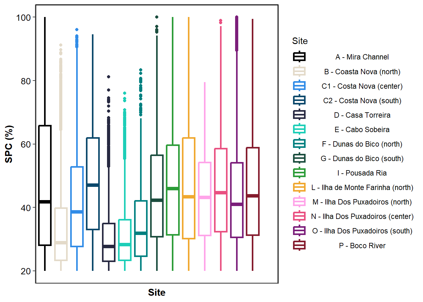
Ria de Aveiro is a shallow coastal lagoon located on the northwest coast of Portugal, near the city of Aveiro. Formed by the Vouga River and connected to the Atlantic Ocean through an artificial inlet, the lagoon is characterized by a complex network of channels, mudflats, and salt marshes. Its wide intertidal zones host extensive seagrass meadows, mainly composed of Zostera noltei, which are most abundant in the inner, sheltered areas of the lagoon. These meadows are typically visible at low tide and contribute to the high ecological value of the system. As shown in Figure 1, the area considered in this study spans approximately 12 km², spread over 14 study sites. Study sites have been chosen to match sites of Sousa et al. (2019)
For this site, a time series of the Sentinel-2 missions has been used to monitor the seagrass meadow since 2017 (Table 1). This work was published by Zoffoli et al. (2021). The present work updates the time series from Zoffoli et al. (2021) by incorporating newly available images and computing additional metrics (see Methodology).
Date | Capteur | Date | Capteur | Date | Capteur |
|---|---|---|---|---|---|
juillet 24, 2017 | Sentinel-2 | juillet 26, 2020 | Sentinel-2 | août 05, 2023 | Sentinel-2 |
juillet 17, 2018 | Sentinel-2 | juillet 13, 2021 | Sentinel-2 | juillet 22, 2024 | Sentinel-2 |
août 03, 2019 | Sentinel-2 | juillet 31, 2022 | Sentinel-2 |
List of Satellite images used to follow the meadows in Aveiro Lagoon
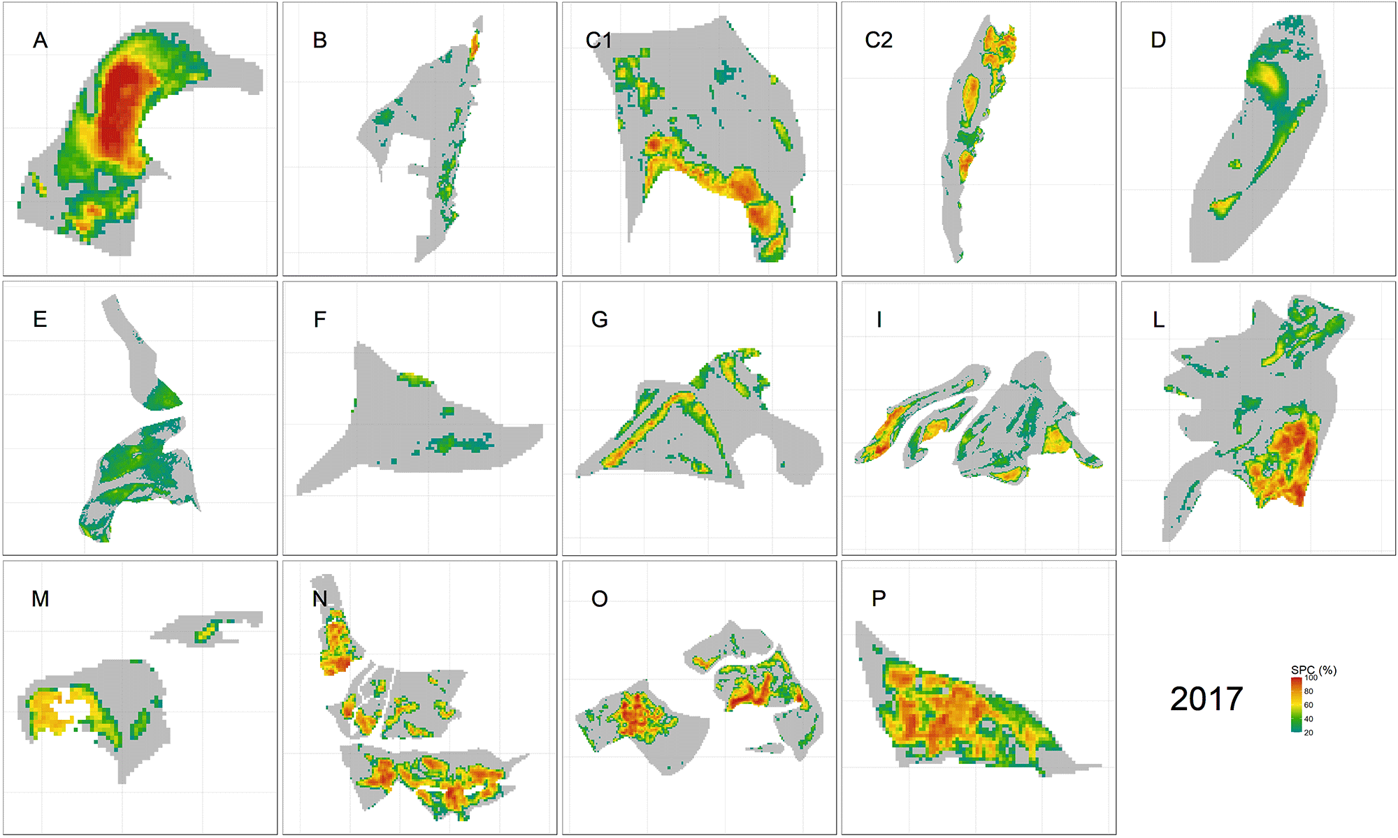
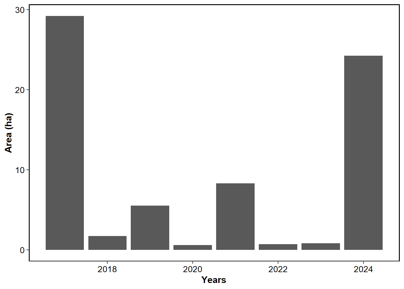
Figure 2 is show the evolution of the Seagrass Cover over time, since 20175. The minimum density was recorded in 2022 with 40% of average cover, while the maximum density has been recorded in 2024 with 51% of average cover.
Historical seagrass patches of the meadow
Year of the maximum of cover